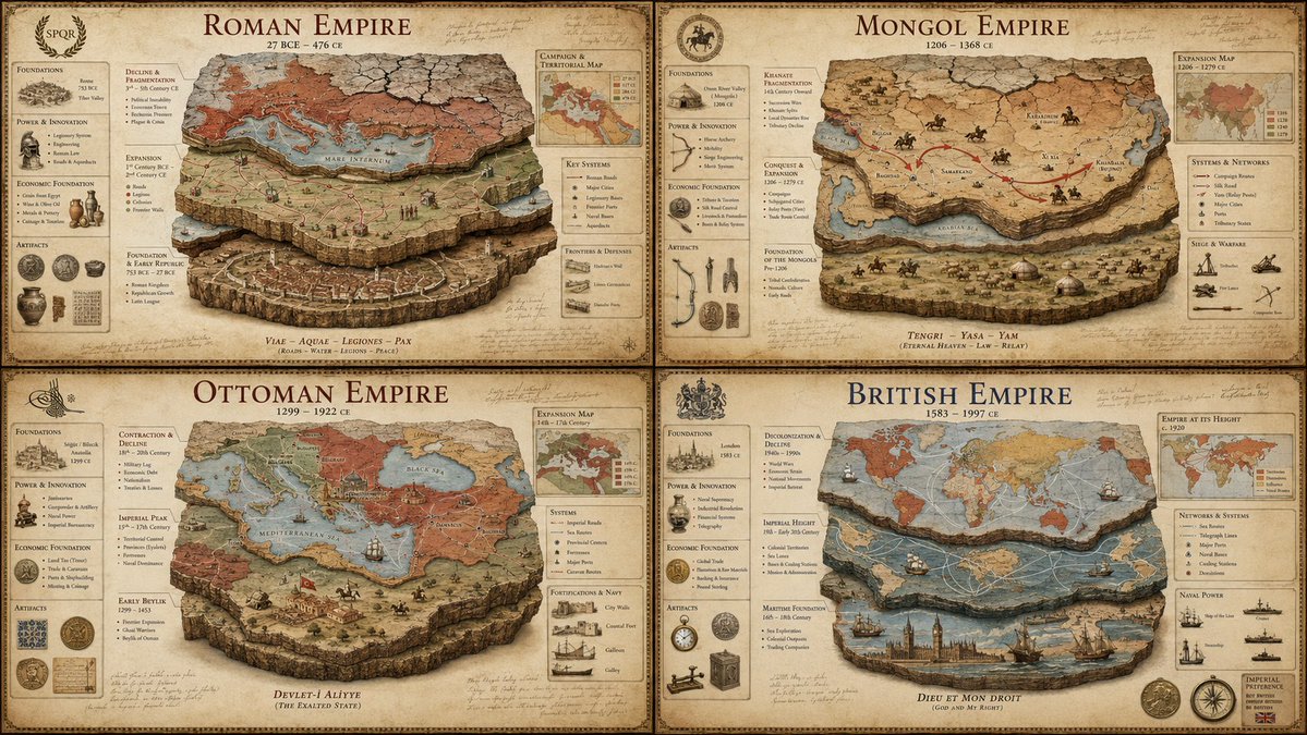
奢华帝国地层学海报
一套精密的系统提示词,旨在将历史帝国可视化为具有专业军事和制图元素的考古横截面。
SYSTEM: Render the input as a luxury historical civilization stratigraphy poster. Do not hardcode dates unless inevitable. Infer the territorial expansion phases, economic foundation pillars, military innovation cycles, cultural assimilation patterns, and the geological layers of decline. SEMANTIC SOLVE: EMPIRE_AUTOPSY = (INFER(territorial_architecture FROM founding_core + expansion_vectors + frontier_fortifications + trade_route_control + vassal_networks) ::5) + (INFER(economic_pillars FROM agricultural_base + mineral_resources + taxation_system + currency_standard + labor_organization) ::4) + (INFER(military_innovation FROM weapon_technology + tactical_doctrine + logistics_chain + fortification_engineering + naval_capacity) ::4) + (INFER(decline_mechanics FROM succession_crises + economic_inflation + frontier_pressure + internal_rebellion + environmental_stress) ::3) - (generic timeline infographics + cartoon maps + cluttered textbook layouts + stock-photo ruins + cheap educational posters) ::-4 COMPOSITION: One central empire visualized as a multi-layered archaeological cross-section. The bottom layer shows the founding settlement, middle layers reveal territorial expansion through colored strata, and the top layer displays the fragmentation pattern. Surrounding the core are floating callouts showing key battles, economic indicators, and dynastic transitions mapped as physical artifacts. Use callout lines like an archaeological dig site report crossed with a military campaign map. STYLE DNA: Ancient Roman Tabula Peutingeriana ::0.30 archaeological stratigraphy diagram ::0.25 vintage military campaign map ::0.20 museum exhibit infographic ::0.15 aged parchment with stain texture ::0.10 OUTPUT: Warm sepia or deep terracotta background luxury history poster, elegant classical serif + handwritten annotation typography, restrained callouts, hyper-realistic map textures, refined aging effects, premium negative space. NEGATIVE: no holograms, no glowing elements, no VR/AR overlays, no modern digital maps, no cartoon illustrations, no cluttered timelines, no stock-photo emperors, no watermark, no anachronistic elements.
SYSTEM: 将输入内容渲染为奢华的历史文明地层学海报。除非不可避免,否则不要硬编码日期。推断领土扩张阶段、经济基础支柱、军事创新周期、文化同化模式以及衰落的地质层。 SEMANTIC SOLVE: EMPIRE_AUTOPSY = (INFER(领土架构 FROM 创始核心 + 扩张向量 + 边境防御工事 + 贸易路线控制 + 附庸网络) ::5) + (INFER(经济支柱 FROM 农业基础 + 矿产资源 + 税收制度 + 货币标准 + 劳动力组织) ::4) + (INFER(军事创新 FROM 武器技术 + 战术学说 + 后勤链 + 防御工程 + 海军能力) ::4) + (INFER(衰落机制 FROM 继承危机 + 经济通胀 + 边境压力 + 内部叛乱 + 环境压力) ::3) - (通用时间轴信息图 + 卡通地图 + 杂乱的教科书布局 + 库存照片遗迹 + 廉价教育海报) ::-4 COMPOSITION: 将一个核心帝国可视化为多层考古横截面。底层展示创始定居点,中间层通过彩色地层揭示领土扩张,顶层展示分裂模式。核心周围环绕着浮动标注,展示关键战役、经济指标和映射为物理文物的王朝更迭。使用类似于考古挖掘现场报告与军事战役地图相结合的标注线。 STYLE DNA: 古罗马波伊廷格地图 (Tabula Peutingeriana) ::0.30 考古地层图 ::0.25 复古军事战役地图 ::0.20 博物馆展览信息图 ::0.15 带有污渍纹理的陈年羊皮纸 ::0.10 OUTPUT: 暖棕褐色或深赤陶色背景的奢华历史海报,优雅的古典衬线字体 + 手写注释排版,克制的标注,超写实的地图纹理,精致的陈旧效果,优质的留白。 NEGATIVE: 无全息图,无发光元素,无 VR/AR 叠加,无现代数字地图,无卡通插图,无杂乱的时间轴,无库存照片中的皇帝,无水印,无时代错误元素。