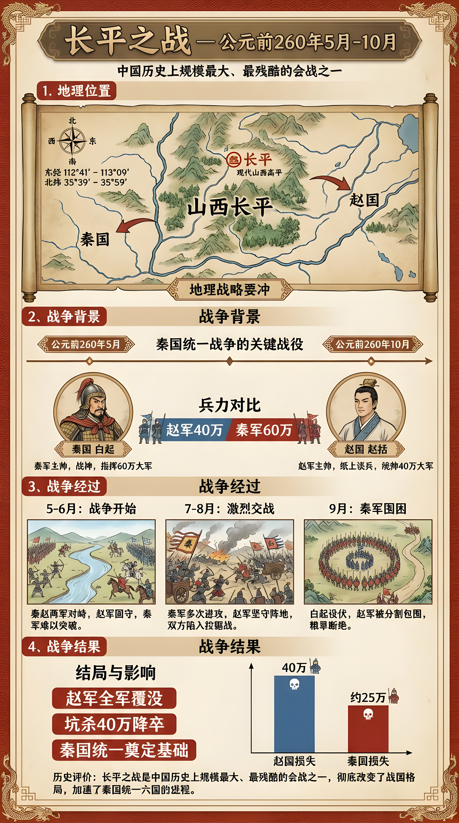
A series of images depicting events occurring between May and October 260 BC, within the geographical coordinates of 112°41′ to 113°09′ East longitude and 35°39′ to 35°59′ North latitude, accompanied by detailed infographics. The infographics must include Chinese captions explaining the events and key outcome information.
用一组图,描绘公元前260年5月至10月之间,东经112°41到113°09′,,北纬35°39′到35°59′ 发生的事情,并给出详细的信息图,图上要用中文说明发生了什么事情,以及结果的重要信息
기원전 260년 5월부터 10월 사이에 발생한 사건들을 묘사한 일련의 이미지, 지리적 좌표 112°41′에서 113°09′ 동경과 35°39′에서 35°59′ 북위 내, 상세한 인포그래픽 포함. 인포그래픽에는 사건 설명과 주요 결과 정보를 담은 중국어 캡션이 포함되어야 함.